 日本語
日本語 English
 中国語
中国語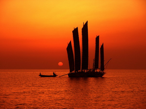
by David Parmer
The eye-catching picture above, taken on Lake Hongze in Jiangsu province, gives a certain impression of beauty and serenity. And maybe some day the Huai River, which flows into the lake, may be both serene and beautiful. However, today the Huai faces two critical challenges; flooding and pollution.
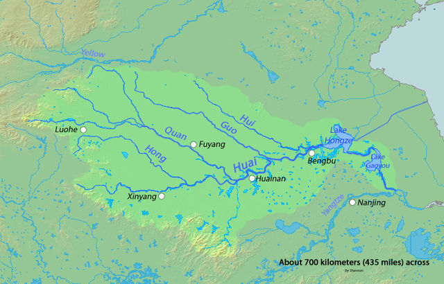
The Huai river which lies between the Yellow River in the North and the Yangtze River in the South is sometimes seen as the unofficial dividing line between North China and South China. It runs 1,000km from Henan province through Anhui, Jiangsu and enters the Yangtze at Jiangsu. The Huai river basin is mostly flatland, good for agriculture, but prone to flooding (Historically, there were an average of 96 floods each year). Since the 1980s river control projects have been conducted to improve river infrastructure and prevent flooding. A $200,000,000 project financed by the World Bank for Huai River Basin Flood Management and Drainage Improvement is ongoing.
By all reports, the Huai river is severely polluted, and cleanup efforts have not created a long-lasting sustainable solution for the waterway. Main polluters were paper manufacturers and the chemical industry. Pollution has produced serious health hazards for residents in many areas along the river. Serious attempts at river cleanup began in 1995, which saw the closing of 5,000 small factories, yet still the problem remains. Added to the chemical threat, there is now the threat of an algal bloom, a threat to plants and wildlife.
Recently we have heard of many versions of the “China Dream.” We can only hope that once version entails a clean and beautiful Huai river, a river restored to its natural state, and a river that is a boon to both man and nature.
Campaigner Wages War on Cancerous River
http://www.globaltimes.cn/special/2009-06/438481.html
Photo: absolutechinatours
Map: Wikipedia