 日本語
日本語 English
 中国語
中国語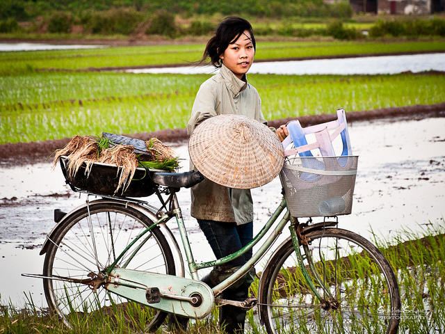
by David Parmer
The story of the Red River (Honghe in Chinese, Hong Ha in Vietnamese) starts and ends with rice. The river flows for 1149 km (714 miles) from China’s Yunnan Province into and through Vietnam, past Hanoi and to Haiphong where it empties into the Gulf of Tonkin.
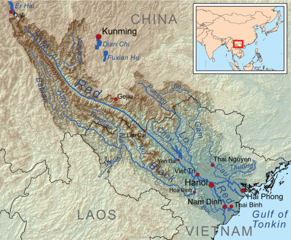
Red River Map (Wikipedia)
As the river begins its journey, it passes the Honghe Hani Rice Terraces a complex ecosystem that has evolved over 1300 years, and is now a UNESCO World Heritage Site. The river leaves the Honghe region and flows into Vietnam’s Lao Cai Province. As it moves south and east, it forms Vietnam’s second most important rice producing area, the Red River Delta, producing about 18% of the country’s export crop. The Delta, made up of eight provinces, covers 15,000 square KM and is formed by the Red River and the Thai Binh River. Eventually the river flows to Haiphong and then into the Gulf of Tonkin.
The Red River in Vietnam faces several challenges. Polluted water from China is reported to be on the increase, water levels are down making pumping stations useless for irrigation, sand exploitation alters river geography and there is the push and pull of agriculture vs. hydro-electric power generation. The biggest issue now facing residents is the proposed Red River Mega Project, a scheme that proposes 5-7 power plants and a canal in a Buy Own Operate (BOO) format that would both alter the river and raise the cost of navigation.
Like the great Mekong River itself, the Red River must be managed in such a way as to address the needs of competing interests and contribute to the long term well being of those dependent on the river for their lives and livelihood.
UNESCO: Honghe Hani Rice Terraces
Viet Nam News: Changing Red River Flow Brings Region Challenges
Photo: Steffan Scherz via flickr