 日本語
日本語 English
 中国語
中国語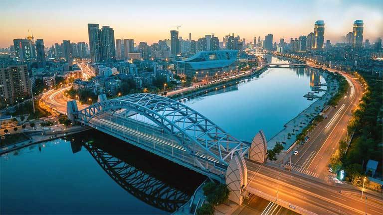
by David Parmer / Tokyo
The concept behind Professor Joseph Needham’s massive work, Science and Civilization In China, was that in ancient times China was at the leading edge of technology while the rest of the world more or less muddled along. As for water management, records show that water management technology was known and practiced some 1500 years ago during the Sui Dynasty (581-618).
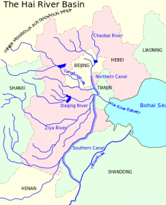
During the Sui, measures were already being taken to control and channel the Haihe or Hai River. Although we can say that the Hai River flows from Beijing to Tianjin and then to the Bohai Sea and that it is more than 1300km in length, this “linear” description would seriously miss the point.
For the Hai is not “a” river, but five bodies of water including the North Canal, the South Canal, the Yongding River, the Daqing River and the Ziya River that flow through Sandong, Hebei, Beijing and Tianjin. And more appropriately, this whole conglomeration can be seen as the Hai River basin encompassing an area of some 318km2
The Hai River in Tianjin is a pretty sight as it flows through the city under a series of attractive low-rise bridges. At night the banks of the river are illuminated, and colorful boats ply the river making for a festive scene. For the greater Bohai basin however, things are not quite so attractive. As with many of China’s other water sources, the twin problems of water pollution and water scarcity also affect the Hai River basin.
Water pollution has increased over the years due to uncontrolled economic development and the use of ground water for agriculture has led to varying degrees of water scarcity. Stakeholders including industry, shipping agriculture and recreation vie for Hai water resources and have all contributed to the water management problems facing the Chinese government.
Efforts to deal with the problems of water scarcity and water pollution were addressed in 2016 by an initiative called the Hai River Basin Project. Those involved were the Chinese government, the World Bank and the Global Environment Facility (GEF). The World Bank advanced US$9.5 billion for the project to create an integrated water and environmental approach to the problem. The project not only examined to Hai River basin, but also its relation to the Bohai Sea. The target for all concerned was to come up with plans to upgrade the water quality and ecosystem sustainability in the Hai River basin.
At the same time, and to the south the government of China was engaged in a civil engineering project of staggering proportions– the South North Water Transfer Project. This scheme called for the transfer of 44.8 billion m3 of water from the Yangtze River to North China. This audacious project called for water resources from southern China to be pumped north via three separate and unique routes.
![]()
The Eastern Route
This route is basically an improvement on the venerable Grand Canal. Work began in 2002 and after delays was finished in 2014. The water transfer involves 13 pumping stations and a tunnel under the Yellow River traveling 1150 km before finally reaching the Tianjin area.
The Central Route
This route was started in 2003 and completed in 2014. It travels 1246km from the Danjiangkou Reservoir on the Han River to the Beijing area. While this route had the force of gravity on its side and did not require the pumping stations found on the eastern route, it did have serious environmental impacts in the form of the necessity to relocate 300,000 people.
The Western Route
Planned, but yet to be built, the Western route is the most ambitious and most audacious of the three routes. The plan is to divert waters of the upper Yangtze River to the Yellow River. It will cross the Tibetan and Yunnan Plateaus through a combination of dams and tunnels and then cross the Bayankala Mountains to northwest China. Besides being the most challenging of the three routes, the Western route also creates challenges in the areas of transboundry waters. Water diversion for this route would affect the great rivers of China’s neighbors; the Mekong, the Brahmaputra and Indus rivers.
There has been criticism of the South North Water Transfer Project in terms of sustainability, environmental damage and the displacement of peoples. In spite of this water flows north to Beijing, Tianjin and the Hai River basin where it is needed for agriculture and industry. The challenge now that water scarcity has been addressed is to keep water quality high in other areas so they can enjoy the benefits of fresh, clean water, as do the inhabitants of Tianjin on a regular basis. More needs to be done in terms of water conservation and wise water use and tough enforcement of water pollution rules, but attention will have to stay focused on this vital resource, not just for the Hai River but also for all water resources throughout China.
Photo: Tianjin Docsteacher Hai River
Illustration: Hai River Basin Wikipedia
Illustration: South North Water Transfer Project Ran Xin
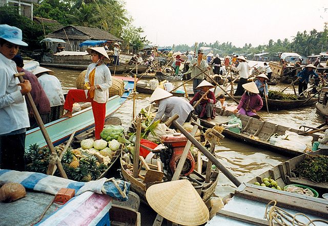 Mekong Floating Market Viet Nam (Wikimedia)
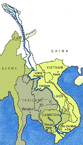
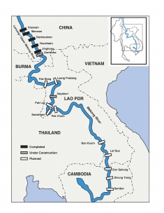 Dams (Proposed and Existing) on the Lower Mekong