U.S. General Mark Milley: “China is not an Enemy”

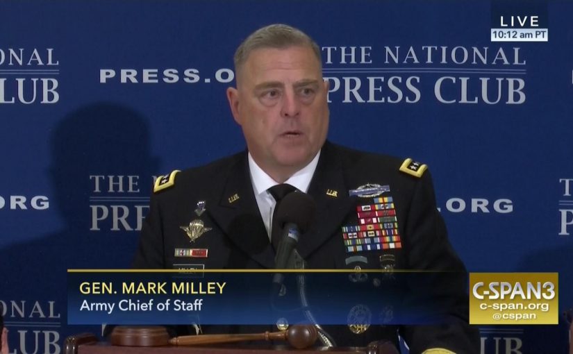
                          by David Parmer/Tokyo

At an event at the National Press Club on July 27, in Washington, Chief of Staff of the United States Army General Milley laid out US global policy in a direct and concise manner. The general touched on three main areas and explained current US Army and US government thinking on them:

  • Security Challenges
  • Army readiness
  • Myths about the military 

Security Challenges

Milley said the US faces four nation states:

  • Russia
  • North Korea
  • China
  • Iran

And one non-state actor:

  • Terrorists

He said that an adversary must have “capability and will” to engage in or start a conflict. He said Russia is a “purely rational actor” and that despite differences we share areas of common interest.

As for China, he called China a “significant rising power” and that China had made the most significant shift in Global economic power in the last five centuries.”

He said that China also has capability and will, and has laid out its plans for the “China Dream” very clearly. It will proceed peacefully but has a capable military force to back up its interests.

He added, “China is not an enemy. Neither is Russia for that matter.” What is possible is “competition without conflict.”   And “China is also a rational actor.”

Iran tries to undermine U.S. national security interests in the Middle East.

North Korea is “the single most dangerous threat” at the present time.

“Time is running out.”

Terrorism, he said, will be “A long struggle.”

 Army readiness

The general said that the real question about your army is “What do you want it to do?” Since 1945 at the Breton Woods Conference the US has fielded a global military in support of the World Order. The U.S. now has 180,000 soldiers under arms. The General said that he believes we need a bigger Army. He also said that he believes that there has been a change in the character of war, and that future wars will be urban combat following the world trend for urbanization. He citied the battle of Mosul as an example of this trend manifesting in the present.

5 Myths of War

The general listed five myths of war and gave their corollaries in his estimation.

  • Wars will be short–they will not, they will take time
  • You can win wars from afar–you can’t there must be boots on the ground
  • Special Forces can do it all–they can’t and shouldn’t be asked to
  • Armies are easy to create–they aren’t, it takes time and training
  • Armies fight wars–nations fight wars

In closing General Milley took prepared questions. Two significant answers that he gave were regarding the situation on the Korean peninsula.

“No good options”

” It’s not going to be a pretty picture.” (A possible war in Korea)

Video: CSPAN

Photo: CSPAN

Asian Waters–The Frozen Songhua River

                           by David Parmer / Tokyo

Amurrivermap

Northeast China’s Songhua River, China’s most northern river system, starts in an otherworldly location called Heaven Lake on the border with North Korea. The lake is a source for three rivers, the Songhua, the Tumen and the Yalu. Flowing north, and east, it passes the city of Jilin and meanders to Harbin and then joins the mighty Amur River and rolls into Khabarovsk and then on to the sea.

The Songhua is navigable up to Harbin, but for basically half the year, from November till April it is frozen solid. In Harbin the frozen Songhua provides a venue for winter recreation and Harbin’s world-famous Ice Festival.

In history, the Songhua River has been prominent in Chinese-Russian relations and in the building of the China Eastern Railway. In 2005 a chemical spill polluted the drinking water of Harbin and Khabarovsk. Today the Songhua River is quiet, and as the days pass into autumn the water will be getting ready for its annual freeze and Harbin for its festive time.

Source of Songhua, Yalu

Changbi Waterfall, Heaven Lake (China/N. Korea border)

Photo:   Harbin Ice Festival via flickr, Jarod Carruthers

Photo: Changbai Waterfall via flickr, Joe Jiang


Asian Waters—China’s Venerable Grand Canal

 The Grand Canal represents the greatest masterpiece of hydraulic engineering in the history of mankind, because of its very ancient origins and its vast scale, along with its continuous development and its adaptation to circumstances down the ages. It provides tangible proof of human wisdom, determination and courage. It is an outstanding example of human creativity, demonstrating technical capabilities and a mastery of hydrology in a vast agricultural empire that stems directly from Ancient China.   (UNESCO World Heritage List)

                 by David Parmer / Tokyo

Unlike China’s other great treasure, the Great Wall, the Grand Canal is not only an historical relic, but it is also a vibrant part of China’s culture and economy, important today as it was in the 13th century. The 1776 km Hangzhou-Beijing canal, or the Grand Canal, runs from Hangzhou in Zhejiang province through Jiangsu, Shandong, and Hebei provinces. In the North, its route passes Tianjin and ends up in Beijing.

Modern_Course_of_Grand_Canal_of_China

The Grand Canal was started in the late Spring and Autumn period (770-470 BC). The officially agreed upon date seems to be 486 BC. Various sections were linked together during the Sui Dynasty (581-618 AD) and the project reached completion and its near 2,000km length during the Yuan dynasty (1279-1386 AD). Today only the section from Hangzhou to Jining (see illustration above) is navigable. Some sections in the North have dried up and become impassable or are severely polluted. Historically the canal was used to transport grain from southern China to northern China. The bricks for the Forbidden City in Beijing and the timbers for the Ming Tombs also came north along the canal. Since the end of WWII it has been used to transport building materials and fuel. Estimates are that some 100,000 vessels ply the waters of the Grand Canal every year.

China’s rivers generally flow from west to east, and this is one reason why the south to north flow of the Grand Canal is so important. It not only permits the transport of goods from south to north, but also links five of China’s rivers. In addition to the Yangtze and Yellow rivers, it also links the Huaihe, Haihe and Qiantang rivers.

The Grand Canal is indeed an engineering marvel; it is 10 times longer than the Suez Canal and 22 times longer than the Panama Canal. It is also the longest artificial river in the world. The canal is 1.0m below sea level in Hangzhou but 38.5m above sea level in its modern navigational terminus and Jining in Shandong province. There are 24 locks along the river that make this possible.

Grand-Canal

In 2014, the once-neglected Grand Canal was declared an UNESCO World Heritage Site. It is valued for its cultural value as well as its ongoing contribution to China’s economy. Throughout history the canal has brought goods and culture from one part of vast China to the other. Efforts are ongoing to improve not only the maintenance of the waterway but also the communities along its way. It is clear that the Hangzhou-Beijing canal will continue to have a major influence on the region and the country in this century and for centuries to come.


UNESCO World Heritage Centre

http://whc.unesco.org/en/list/1443

China Daily: Multi-part video series on Grand Canal in Chinese with English subtitles

http://video.chinadaily.com.cn/2013/1031/1518.shtml


Photos:

Top: China Discovery

Map: Wikipedia

Bottom: CNTO


Asian Waters—Huang Ho, The River of Many Names

                                  by David Parmer

China’s Yellow River, the Huang Ho, is also known as The Mother River, and more-tellingly, China’s Sorrow. Massive and deadly flooding over the centuries has given it this last name. And it is called the Yellow River because of the color imparted by the Loess soil ( an estimated 1.6 billion tons annually) that it sweeps to the sea.

The Yellow River flows 5,465km from its start in the Bayan Har mountains in Qinghai Province to its terminus where it joins the busy Bohai sea below Beijing. Its route takes it from the Tibet Plateau through the Ordos Desert and the Ordos Loop to the North China plains and then to the sea.

  There are 20 dams along the course of the river, with 18 more planned by 2030. Apparently people have been damming the river since ancient times, often altering the course and causing some of the disastrous floods that history records. The yellow Loess soil is fertile, and supports the cultivation of much of China’s cotton and wheat. And historically, the Yellow river at its western end marks the start of the Silk Road, while the lower Yellow River valley is marked as the starting place for Chinese civilization.

Beautiful and powerful, China’s Mother River is not without her problems. Periodic flooding is caused by deforestation and the embankment of tributaries for irrigation. It has been estimated that 85% of the river’s water is unsafe for drinking. Other estimates say 1/3 of the river is un-useable dew to sewage, industrial chemicals and pesticides.

China Daily Yellow River

 Yellow River Dam Henan (China Daily)

In their paper, “Water Crisis in the Huang Ho (Yellow) River”, G. Fu and S. Chen state:

Industrialization, population growth, and other associated human activities along with global warming and the unique water characteristics and arid and semi-arid climate zone of the Yellow River basin have caused a dry up phenomena in the Yellow River basin during the last three decades.

The authors also write about possible countermeasures:

In order for changes to be made several countermeasures have been proposed. These include: water savings, water management, increased regulation, water transfer, and rational and practical groundwater use.

As we have seen in this series, Asian Waters, many of Asia’s water resources are at risk, and it is only by wise management and long-terms thinking that these resources like the great Yellow River will be preserved and continue to give their countless gifts to humankind on planet Earth.

Water Crisis in the Huang Ho http://archive.riversymposium.com/2004/index.php?element=Fu+Guobin

Main Photo: Global Water Partnership


Dunhuang Project Puts Spotlingt On Teamwork.

                                                                            Dunhuang.jpg

                           (Photo: Friends of Dunhuang)

                              by David Parmer

While the media spotlight in Asia focuses on territorial issues and frictions, scholars, historians and preservationists from seven countries are working through the International Dunhuang Project (IDP) cooperate to digitize some of the planet’s most valuable artifacts.

The National Library of China and seven major libraries and research institutions worldwide are cooperating to digitize and share some of the world’s most important cultural data. These countries include China, Britain, Russia Korea, Japan, Germany and France. The data in question is a massive digital representation of the artifacts found in the Mogao caves located 25 km southwest of Dunhuang, China.

Dunhuang, in western China’s Gansu Province, is at the crossroads of the ancient Silk Road. The Dunhuang area, which was declared an UNESCO World Heritage Site in 1987, is home to a system of 492 temples and an amazing 735 Buddhist caves. At the end of the Qing dynasty a treasure trove of ancient scrolls and manuscripts, including one of the oldest known copies of the Diamond Sutra were found.

Materials dating from 100 BC to 1200 AD were removed and dispersed worldwide and now reside in museums in Beijing, St. Petersburg, London, Berlin and Beijing. These materials include scrolls paintings, murals, artifacts, coins and manuscripts in over twenty different languages and scripts. While many are strictly Buddhist in nature others are secular and deal with everyday administrative matters.

Now the IDP is collaborating to make these materials available online. To date, a staggering 400,000 images can now be viewed on the various member sites.
The IDP was formed in 1994 with it directorate at the British Library and has centers in China, Japan, Korea, Germany, Russian and France.
You can find this amazing story on the IDP website. (http://idp.bl.uk/idp.a4d). (DP)